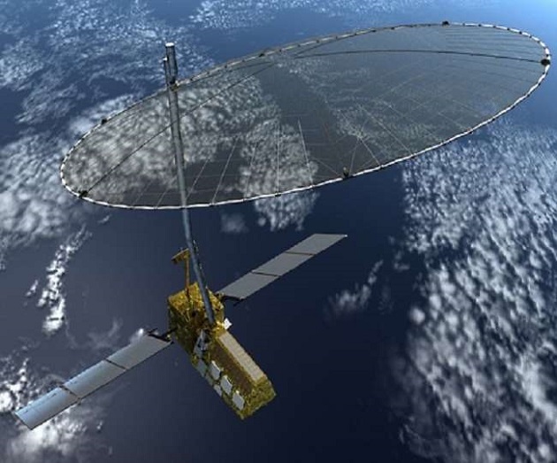
The Indian Space Research Organisation (ISRO) has completed the development of a radar for the joint earth observation satellite mission with the US space agency National Aeronautics and Space Administration (NASA). ISRO has developed a Synthetic Aperture Radar (SAR), capable of producing extremely high-resolution images for the mission.
NASA-ISRO SAR (NISAR) is a joint collaboration for a dual-frequency L and S-band SAR for earth observation. “NISAR will be the first satellite mission to use two different radar frequencies (L-band and S-band) to measure changes in our planet’s surface less than a centimeter across,” NASA said.
NASA and ISRO had signed a partnership on September 30, 2014, to collaborate on and launch NISAR which is targeted to launch in early 2022 from Sriharikota spaceport in Andhra Pradesh.
NASA providing the mission’s L-band SAR, a high-rate communication subsystem for science data, GPS receivers, a solid-state recorder and payload data subsystem.
Isro is providing the spacecraft bus, the S-band radar, the launch vehicle and associated launch services for the mission, whose goal is to make global measurements of the causes and consequences of land surface changes using advanced radar imaging.
The S-band SAR payload of the NISAR satellite mission was flagged off by the Secretary in the Department of Space and ISRO Chairman K Sivan on March 4 through virtual mode.
The payload has been shipped from ISRO’s Ahmedabad-based Space Applications Centre (SAC) to NASA’s Jet Propulsion Laboratory (JPL) at Pasadena in the US for integration with the latter’s L-band SAR payload, an ISRO statement said.
“NISAR would provide a means of disentangling highly spatial and temporally complex processes ranging from ecosystem disturbances to ice sheet collapses and natural hazards including earthquakes, tsunamis, volcanoes and landslides”, ISRO said.
NASA added that the mission will measure Earth’s changing ecosystems, dynamic surfaces and ice masses, providing information about biomass, natural hazards, sea-level rise and groundwater, and will support a host of other applications.
“NISAR will observe Earth’s land and ice-covered surfaces globally with 12-day regularity on ascending and descending passes, sampling Earth on average every six days for a baseline three-year mission”, NASA said on the mission’s website.
“This allows the mission to observe a wide range of Earth processes, from the flow rates of glaciers and ice sheets to the dynamics of earthquakes and volcanoes”.
Over the course of multiple orbits, the radar images will allow users to track changes in croplands and hazard sites, as well as to monitor ongoing crises such as volcanic eruptions. The images will be detailed enough to show local changes and broad enough to measure regional trends.

